What are 5 facts about the River Thames?
Five checkable facts about the Thames: its length, its twice-daily tide, the 1,145 seals in its estuary, the 20 million tonnes its new tunnel has captured, and London's first bathing water.
 By James Whitfield, London river and travel writer
Booking Choice
Five sourced facts, two of which did not exist three years ago. The best place to test any of them is the middle of the water, and boats leave every half hour.
Most lists of Thames facts recycle the same half-remembered claims, several of which nobody can source. This one does the opposite: five facts, each with a figure behind it and a body that publishes the figure, and nothing included that could not be checked before publication. Where a popular claim failed that test, it is not here.
The five sit in a deliberate order, from the geography that never changes to the designation that arrived in 2026. Each one gets a short section below with the detail, the caveats and what it means if you are standing on a bridge looking at the water.
What are 5 facts about the River Thames?
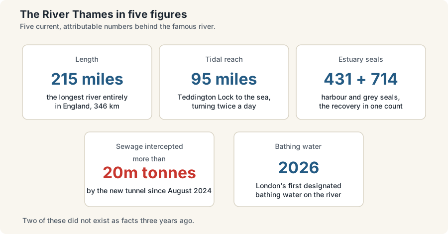
One: it runs about 215 miles and is the longest river entirely in England. Two: it is tidal for 95 miles, rising and falling twice a day, with the limit at Teddington Lock. Three: the estuary holds 431 harbour seals and 714 grey seals. Four: a tunnel under it has captured over 20 million tonnes of sewage since 2024. Five: London got its first designated bathing water on the river in 2026.
Those five were chosen because each is current, each is attributable, and each changes how you look at the river rather than just adding trivia. Two of them did not exist as facts three years ago, which is the interesting part: the Thames is one of the few famous rivers whose basic description has genuinely changed this decade.
| Fact | The figure | Why it matters |
|---|---|---|
| Length | About 215 miles, 346 km | Longest river entirely within England; the Severn is longer but starts in Wales |
| Tidal reach | 95 miles, Teddington to the North Sea | The river rises and falls twice daily and runs at speed in both directions |
| Seals | 431 harbour, 714 grey in the estuary | The clearest single measure of the river's recovery |
| Sewage intercepted | More than 20 million tonnes since August 2024 | The new tunnel is why spill numbers collapsed in 2025 |
| Bathing water | First London designation, 2026 season | Monitoring obligation on a river reach for the first time |
Fact one: how long is the River Thames?
About 215 miles, or 346 kilometres, from a Gloucestershire field to the North Sea, which makes it the longest river lying entirely within England. The Severn beats it at roughly 220 miles but rises in Wales. The Thames Path national trail follows 185.2 miles of it, from the source to the Woolwich Foot Tunnel.
The source is the part that starts arguments. The conventional marker is Thames Head near Kemble, a field that is dry for much of the summer. The rival claim points to Seven Springs, the source of the River Churn, which joins the main river near Cricklade and would add about fourteen miles, taking the total to roughly 229 miles and overtaking the Severn. No legally designated source settles the question, so both numbers circulate.
The river changes hands along the way. From the source down to Teddington Lock it is non-tidal, roughly 147 miles of locks, weirs and market towns managed by the Environment Agency. Below Teddington the Port of London Authority takes over about 95 miles of tidal water running out to the North Sea. That handover point, not the M25 and not the city boundary, is the real dividing line in how the river behaves.
Walking it is a recognised trip. The Thames Path national trail covers 185.2 miles, about 298 kilometres, and takes roughly fourteen days at a moderate pace. At Woolwich it links to the England Coast Path to form a continuous source-to-sea route of around 232 miles. The London section of that walk pairs unusually well with a boat: sail one direction, walk the other, and you see both faces of the same reach.
Fact two: the Thames is tidal through London, twice every day
The tidal Thames runs 95 miles from Teddington Lock to the North Sea and turns twice a day, every day. The tidal stream can run at around five miles an hour, faster than most people swim, and the port receives more than 12,000 commercial vessels a year, making this the busiest inland waterway in the United Kingdom.
This is the fact that surprises visitors most, because nothing about a city-centre river suggests the sea is involved. It is. Twice a day the water reverses, the foreshore appears and disappears, and the level at any set of river stairs changes by hours rather than by season. Stand on Waterloo Bridge in the morning and again at teatime and you are looking at two different rivers.
The consequences are practical rather than decorative. Exposed foreshore at low water is what makes the mudlarking finds possible in the first place, a subject covered in the strangest things pulled from the Thames. Sailing times on some routes genuinely shift with the tide, particularly the longer upstream runs to Kew and Hampton Court, while the central sightseeing timetables are fixed and published. And pier access can change: at least one operator notes that the brow at certain piers becomes too steep for wheelchair users depending on the tide.
The speed is the safety story. A stream running at around five miles an hour, with eddies and undertows forming around bridge piers and moored vessels, is why the PLA restricts swimming to particular reaches and why swimming through central London is not permitted. The authority's own safety guidance for the tidal Thames lists the traffic volume, the cold-water shock risk and the debris alongside the current.
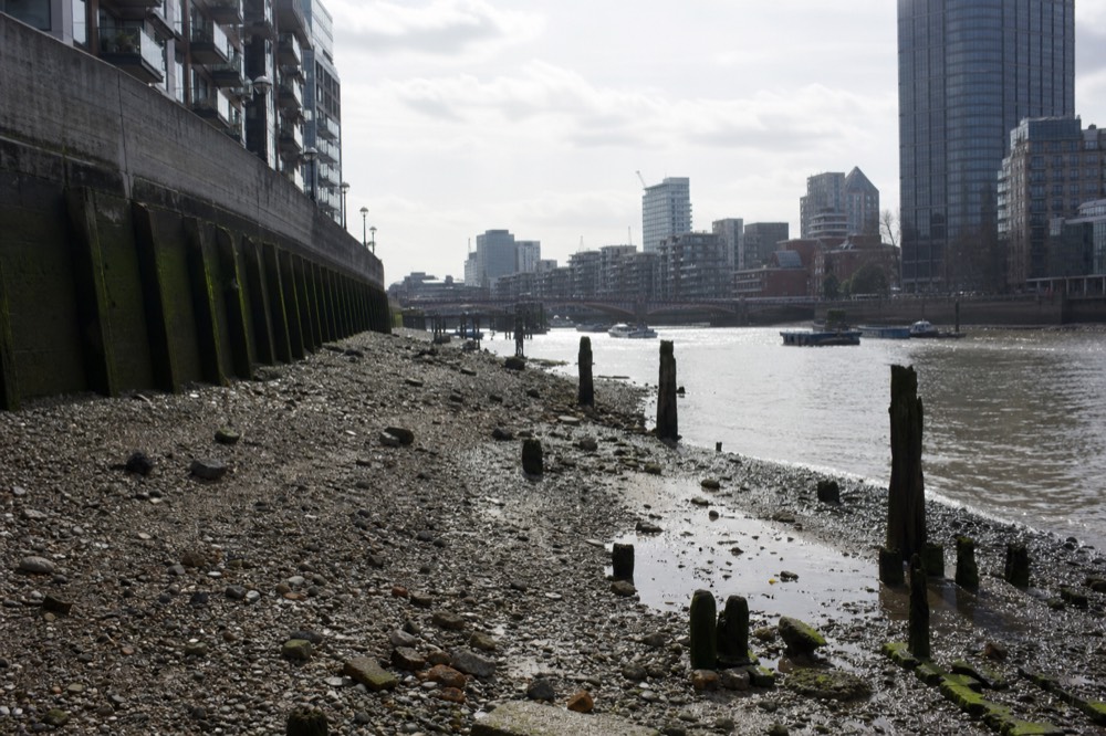
The clearest way to watch the tide do its work is from the middle of it. A forty-minute circular from the pier at the foot of the London Eye crosses the central bend and turns back, so on a falling tide you see the same stretch of foreshore twice, wider on the return leg than it was on the way out.
Fact three: 1,145 seals live in the Thames estuary
Aerial surveys of the Greater Thames Estuary count 431 harbour seals and 714 grey seals hauled out on the sandbanks, alongside short-snouted seahorses recorded as far upstream as Battersea, European eels, and small shark species including tope, starry smoothhound and spurdog.
The seals are the fact that does the most work in conversation, because they are large, real and countable. They live at the estuary end rather than in central London, on the sandbanks off Essex and Kent, and the counts come from aerial survey work rather than from anecdote. Grey seals have shown short-term population increases in the most recent assessment.
The seahorses are the more startling entry. Short-snouted seahorses have been recorded in the tidal Thames with records extending as far upstream as Battersea, which is deep inside the city, on the reach immediately above the permitted swimming boundary at Putney Bridge. Nobody sees them from a boat, and that is not the point: their presence is a water-quality verdict delivered by an animal rather than a laboratory.
| Species or indicator | Current position |
|---|---|
| Harbour seals, Greater Thames Estuary | 431 counted |
| Grey seals, Greater Thames Estuary | 714 counted |
| Short-snouted seahorses | Recorded upstream as far as Battersea |
| Shark species present | Tope, starry smoothhound, spurdog |
| European eels | Present in the tidal river |
| Wading birds | Long-term increases across a range of species |
| Intertidal habitat | Being restored; acts as a fish nursery |
| Fish species in tidal areas | Slight decline since the early 1990s |
The Zoological Society of London published its second State of the Thames assessment in January 2026, built on 21 indicators, and the State of the Thames project is where the counts come from. The report is not a clean-sweep good-news story, which matters when repeating it: fish species in tidal areas have declined slightly since the early 1990s, nitrate concentrations from treated effluent are rising, and warming water sits among the listed pressures.
Fact four: a tunnel under the river has captured more than 20 million tonnes of sewage
The Tideway tunnel, 25 kilometres long and built beneath the riverbed through London, has intercepted more than 20 million tonnes of sewage since it began taking connections in August 2024. Storm-overflow spills across the network fell from 23,061 in 2024 to 9,186 in 2025, a drop of about 60 per cent.
The scale is easier to hold if you break it down. By 31 March 2026 the system had captured roughly 19.6 million tonnes across more than a thousand separate interception events, with about 13.3 million tonnes of that in the 2025/26 financial year alone. The cumulative figure passed 20 million tonnes by the following June. It is designed to last more than 120 years.
The reason it exists is a Victorian design decision. London's sewers, built from 1859 under Joseph Bazalgette after the Great Stink of 1858, carry rainwater and waste in the same pipes, so when heavy rain fills them the overflow goes into the river by design. The tunnel gives that overflow somewhere else to go. The wider history of how the river got into that state is in why the Thames is so famous.
Honesty about the 60 per cent matters. The water company attributes the fall both to the new tunnel capacity in central London and to a drier summer in 2025, and it treats 99.46 per cent of wastewater entering the system in an average year. A wetter year would push the spill count back up without the tunnel having failed. The trend is genuine; the single-year figure is partly weather.
| Milestone | What happened |
|---|---|
| August 2024 | The tunnel takes its first connections and starts intercepting storm flows |
| February 2025 | Remaining connections complete; the system reaches full operation |
| Calendar 2025 | Spills fall to 9,186 across 580 storm overflows, from 23,061 |
| 31 March 2026 | About 19.6 million tonnes captured across more than 1,000 interceptions |
| June 2026 | Cumulative capture passes 20 million tonnes |
Fact five: the Thames in London got its first designated bathing water in 2026
A stretch at Ham and Kingston became the first designated bathing water on the Thames in London, effective for the 2026 season and announced in May 2026 as one of thirteen new sites across England. Designation means the Environment Agency samples and classifies the water. It is not a certificate that the water is clean.
That distinction did real work in its first summer. Post-designation monitoring recorded potentially toxic blue-green algae blooms during summer 2026 and elevated E. coli readings following a spill, with the site not yet fully classified while sampling continued. Which is exactly what a monitoring designation is for: before it existed, nobody had to look.
The national context sets the scale. England assessed 449 designated bathing waters in the classifications published in November 2025, of which 417, or 92.9 per cent, met at least the minimum Sufficient standard and 297, or 66.1 per cent, were rated Excellent. Almost all of those are coastal beaches with long monitoring histories. A newly designated urban river reach begins from somewhere very different, and the official list of designated bathing waters in England is where its status will be recorded as the classifications build.
Location matters too. Ham and Kingston sits in the upper reaches of south-west London, well above the point at Putney Bridge where the Port of London Authority closes the river to swimmers. Nothing about the designation changes the position in central London, where swimming remains outside the permitted areas regardless of water quality.
What else is worth knowing about the Thames?
Four more, all sourced: the Thames Barrier has closed 211 times since 1982; the port receives over 12,000 commercial vessels a year; London river services hit a record 10.5 million journey stages in 2024/25; and three UNESCO World Heritage sites sit on the banks within a dozen miles of each other.
The Barrier is the river's most consequential piece of engineering and the least visited. Operational since 1982, run by the Environment Agency and built for roughly £535 million, it closes to hold out North Sea storm surges rather than to control rain-driven flooding from upstream. Its 211 closures cluster in wet winters, and estuary sea level rising at about 4.1 millimetres a year between 1993 and 2024 is why the defence programme is under continuous review.
The traffic figure reframes the whole river. More than 12,000 commercial vessels a year make this the busiest inland waterway in the country for freight and passengers alike, which is why swimming is restricted through the centre and why the foreshore rules exist. The passenger side of that hit a record 10.5 million journey stages in 2024/25, up about 9 per cent, though the tour and charter share of it fell about 8 per cent over the same period.
Two historical figures round the picture out, and both are stranger than the modern ones. The river froze hard enough for fairs to be held on the ice, with the last major frost fair in February 1814, so within living memory of the Georgian city people walked, traded and set up printing presses on water that now never freezes. And the Pool of London, the reach just below London Bridge, handled overseas trade that grew from 1,682 ships and 234,639 tons in 1751 to 3,663 ships and 620,845 tons by 1794, with coastal traffic nearly doubling over the same decades to almost 12,000 vessels a year. The reason the river no longer freezes is partly the same reason it stopped being a forest of masts: the embankments narrowed it, the flow quickened, and the port moved downstream to deeper water.
The World Heritage cluster is the cultural equivalent. Westminster was inscribed in 1987, the Tower of London in 1988 and Maritime Greenwich in 1997, and the boat between Westminster and Greenwich passes all three inside an hour. There is also a fifth, quieter fact for anyone who likes rules: searching the foreshore between Teddington and the Thames Barrier requires a Port of London Authority permit costing £42 a year, and the waiting list for one passed 10,000 people before registrations were suspended.
How do you actually see all of this from the water?
Pick by how much time you have. Forty minutes from the London Eye at £15.50 covers Parliament, the South Bank and the bridges. An hour from Westminster to Greenwich at £17.20 adds the Tower, Tower Bridge and the maritime buildings. A 24-hour pass at £24.95 lets you stop at four piers, and a 70-minute RIB at £75.48 reaches the Barrier.
The short circular is the efficient version. Forty minutes from the foot of the wheel gives you the central bend, which is where the tide, the bridges and the postcard buildings all overlap, and it rates 4.8 on the listings. It skips everything east of the City, so it is the wrong choice if the Barrier or Greenwich is what you came for. The London Eye river cruise guide sets out the route in full.
For the full sweep, the downstream hour is still the one to beat. It runs the whole famous stretch one way, carries 25,220 traveller reviews at 4.5 stars, and drops you at Greenwich with the Cutty Sark and the Observatory in front of you. The Westminster to Greenwich route breaks down the piers and timings, and the live availability on your date is worth checking before summer mornings, which fill first.
If facts three and four are what interest you, the fast boats go furthest east and pass the Barrier itself, and you can see what a Barrier run costs on a given day. Every sailing on the river is priced and ranked on Thames River Cruises, the head-to-head sits in the best cruise comparison, and if you are weighing whether any of it justifies the fare, the worth-it question settles it with prices and ratings rather than adjectives.
Common questions
How long is the River Thames?
About 215 miles, or 346 kilometres, from Thames Head in Gloucestershire to the North Sea, making it the longest river entirely within England. The Severn is longer at roughly 220 miles but rises in Wales. If the source is measured from Seven Springs instead, the total rises to around 229 miles, which is why two different figures circulate.Is the River Thames tidal in London?
Yes. The tidal Thames runs 95 miles from Teddington Lock out to the North Sea, and the water rises and falls twice every day. The tidal stream can reach around five miles an hour, the foreshore appears and disappears with it, and sailing times on some upstream routes shift day to day as a result.What animals live in the River Thames?
Harbour and grey seals, with 431 and 714 respectively counted in the estuary, plus short-snouted seahorses recorded as far upstream as Battersea, European eels, and small sharks including tope, starry smoothhound and spurdog. Wading bird populations have increased over the long term, though the number of fish species recorded in tidal areas has slipped slightly since the early 1990s.Is the River Thames clean now?
Much cleaner than a decade ago and still weather-dependent. A tunnel under the riverbed has intercepted more than 20 million tonnes of sewage since August 2024, and network-wide storm-overflow spills fell from 23,061 in 2024 to 9,186 in 2025. London's sewers still combine rainwater with waste, so heavy rainfall can push untreated flows into the river.What is the most interesting fact about the Thames?
That its basic description keeps changing. Two of the five facts here, the tunnel capture figures and London's first designated bathing water on the river, did not exist three years ago. A river that was a byword for pollution now supports more than a thousand seals in its estuary and has a monitored swimming reach upstream of the city.Five facts, five sources, and a river that is measurably different from the one described in most guidebooks. The tide will turn twice tomorrow whatever anyone writes about it, the seals will still be on the sandbanks, and the best place to test any of this remains the middle of the water rather than a bridge above it.
Choose Your Thames Cruise
Start Here: An Option For This Trip
Have a travel date in mind? Choose your date to your hour on the landmark run before arranging the rest of your day.
1 hour one-way from Westminster Pier to Greenwich past St Paul's, the Tower and Tower Bridge, live English commentary, from £17.20, rated 4.5 across 25,220 GetYourGuide reviews, free cancellation on most dates.
Check Dates For Westminster to Greenwich Sightseeing CruiseNo verified cruise on this site matches those choices. Adjust them, or reset for the editorial recommendation.
Compare Options, Match Your Day And Estimate Costs
- Westminster to Greenwich Sightseeing Cruise: 1 hour one-way from Westminster Pier to Greenwich past St Paul's, the Tower and Tower Bridge, live English commentary, from £17.20, rated 4.5 across 25,220 GetYourGuide reviews, free cancellation on most dates.
- London Eye River Cruise: 40-minute circular from London Eye Pier, Big Ben and the South Bank waterfront, live guide, from £15.50, rated 4.8 across 1,912 Viator reviews, free cancellation on most dates.
- 70-Minute RIB Voyage to the Thames Barrier: 70-minute high-speed RIB from Embankment Pier to the Thames Barrier and back, the full length of the tidal river, from £75.48, rated 4.9 across 803 Viator reviews, free cancellation on most dates.
- Tower Bridge Circular Cruise from Westminster: 1-hour circular from Westminster Pier to St Katharine's and back, turning under Tower Bridge, from £14, rated 4.2 across 523 Viator reviews, free cancellation on most dates.
- River Thames Hop-On Hop-Off Cruise, 24-Hour Pass: 24-hour pass between Westminster, London Eye, Tower and Greenwich piers, hop as often as you like, live commentary, from £24.95, rated 4.4 across 3,283 GetYourGuide reviews, free cancellation on most dates.
Compare Your Whole-Party Costs
Enter what you would pay in the same currency for the cruise and for your alternative, including transport and meals for each.